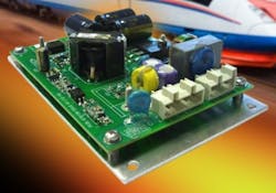
WASHINGTON, 18 Aug. 2011. The ITT Corp. Geospatial Systems segment in Rochester, N.Y., and Mercury Computer Systems Inc. in Chelmsford, Mass., are introducing the Federated Embedded inteL-server for Collaborative Operations (FELCO) processing solution to help process raw sensor imagery and metadata from manned and unmanned surveillance aircraft into open-standards geospatial intelligence while the surveillance aircraft is still in the air.FELCO is designed to help the warfighter use data quickly to make decisions. The sensor-processing tool helps reduce processing time lag and produces a DVR-like product that warfighters in the field can stop, rewind, review in slow motion, and resume live video. Users can customize the information stream to their needs. ITT and Mercury introduced FELCO this week at the this week at the Association for Unmanned Vehicle Systems International (AUVSI) Unmanned Systems North America trade show in Washington.Developed on the Mercury Computer Systems (NASDAQ: MRCY, www.mc.com) Application-Ready Subsystems (ARS), FELCO uses the company's Powerblock processing architecture and the ITT (NYSE: ITT) open-standards processing, exploitation, and dissemination (PED) software, Enhanced AGILE Access, and AdLib. FELCO was designed initially for small tactical unmanned aerial vehicles (UAVs), and can scale to 3U and 6U circuit card form factors.
The processing system forms information layers, including standards-based imagery and video, GPS, and moving target indicators, and transmits to one or more users in a standards-based interoperable format, company officials say.
Systems integrators with existing infrared, radar, other sensors can upgrade legacy onboard basic-downlink mission computers to the more advanced FELCO solution, company officials say. The size and power requirements of FELCO make it suitable for rugged airborne, mobile, and fixed configurations, including aerostats, helicopters, fixed-wing aircraft, and surveillance towers.
For more information contact ITT Geospatial Systems online at www.geospatial.itt.com, or Mercury Computer Systems at www.mc.com.
Related stories
-- Video and image processing at the edge;
-- COTS and open standards drive unmanned vehicle control station architectures;
-- Video processing system helps transform airborne sensor imagery into actionable intelligence while on the move.