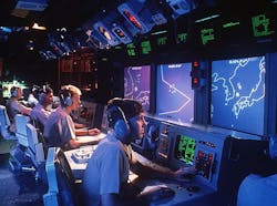
This imaging dome around and above the ship would enable ship crews to maintain situational awareness in the open ocean, along coasts, and inside harbors to detect, locate, and track potential airborne and surface threats like missiles and fast attack boats.
Officials of the Office of Naval Research (ONR) in Arlington, Va., issued a request for information Thursday (N00014-16-RFI-0002) for the Hemispherical Imaging for Situational Awareness project to create a dome of imaging capability around surface ships.
The previous day ONR experts released a request for information for the Imaging Through Obscurants project, which seeks to develop electro-optical shipboard electro-optical sensors able to see through fog, haze, rain, and snow. Both projects are part of the ONR Code 312 EO-IR Technologies Focus Area.
The Hemispherical Imaging for Situational Awareness project seeks the ability to monitor the entire hemispherical dome (360 degrees azimuth by 90 degree vertical) for potential threats around surface vessels. Conventional imaging sensors, however, are too inefficient for this job.
Related: Navy considers 360-degree multispectral persistent surveillance for surface ship defense
Conventional imaging sensors would lead to single frames with hundreds of megapixels of data, in which more than 90 percent of the pixels do not contain meaningful or relevant information, and so are extremely inefficient.
story continues below
Navy researchers also are trying to deal with other challenges of creating an imaging dome around surface ships. The vertical angle changes from near the horizon to directly overhead, for example, and the background and expected threat signatures also change dramatically with range and angle.
Although researchers primarily are interested in visible-light and infrared sensors for this project because of their superior resolution, they also are considering the passive millimeter wave sensors for their ability to image through clouds, dust, fog, and rain.
Prior research has suggested alternatives to conventional imaging sensors that produce far lower volume of data without compromising resolution by tailoring measurements by incorporating prior information about the background and target statistics.
Related: Navy looking for new sensor technologies to see through fog, haze, rain, and snow at sea
Employing multi-modal sensing that detects spectral, polarization and temporal signatures is another approach to reducing the data volume that conventional imaging sensors generate.
The goal of the project is to find unconventional approaches to full hemispherical imaging for situational awareness generate data more efficiently than conventional imaging sensors, with high probability of detection and low false alarm rates.
Companies interested should email ideas no later than 19 Feb. 2016 to the Navy's Ravi Athale at [email protected]. Put Hemispherical Imaging for Situational Awareness in the subject line. Email questions or concerns to Athale at the above address.
More information is online at https://www.fbo.gov/spg/DON/ONR/ONR/N00014-16-RFI-0002/listing.html.


