IARPA seeks to image geosynchronous objects for space situational awareness
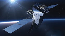
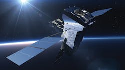
WASHINGTON - U.S. intelligence experts are launching an initiative to develop space situational awareness precision imaging technology sufficient to gather high-resolution images of objects orbiting in geosynchronous orbit from installations on the ground.
Officials of the U.S. Intelligence Advanced Research Projects Agency (IARPA) in Washington are briefing industry on the upcoming Amon-Hen program to produce images of objects in geosynchronous orbit, which is 22,236 miles above the Earth's surface. IARPA's Amon-Hen program seeks to develop ground-based GEO imaging that enables rapid collection of data for inteferometric image reconstruction of geosynchronous objects at low cost.
One potential technology approach to the Amon-Hen project is to use a large number of small apertures. In addition to reducing costs, small aperture could enable simultaneous measurements at a large number of baselines, reducing acquisition timelines and increasing the number of geosynchronous objects imaged in one night.
The goal of the Amon-Hen program is to develop a low-cost, passive, ground-based, optical interferometer that from the ground can resolve images in geosynchronous orbit to 12.5 nanoradian angular resolution, and then convert one night's imaging data to a final image.
Imaging data from one geosynchronous object must be completed in less than one hour. Image interpretability must be equivalent to Space Object Rating Scale (SORS) Level 6 or better.
Geosynchronous orbit is of particular interest to U.S. intelligence experts because it is the altitude at which orbiting remote-sensing satellites maintain the same position above the Earth's surface; the Earth does not rotate underneath the spacecraft as it does with satellites orbiting at lower altitudes.
As more nations become active in space, U.S. intelligence agencies have an increasing need for space situational awareness, particularly timely information about systems and activities in geosynchronous Earth orbit.
The U.S. Senate Armed Services Committee has identified the need to develop ground-based capabilities for passive imagery of geosynchronous objects to provide a credible layer of accountability for behavior in space.
Since objects in geosynchronous orbit are 22,236 miles above the Earth's surface, these objects appear from the ground to be so small and dim that telescopic observation cannot provide imagery of sufficient resolution for the space situational awareness needs of the military and intelligence community. The altitude of geosynchronous orbit is nearly three times the diameter of Earth.
Different ground-based approach- es to image geosynchronous objects have focused on interferometers, such as the Naval Precision Optical Interferometer (NPOI) and the Mag-dalena Ridge Optical Interferometer (MROI), both of which have active research programs in geosynchro- nous imaging. Because geosynchronous objects are dim, however, finding and measuring the interference fringes developed between any two apertures in the interferometer is challenging.
The complex shape of geosynchronous objects also reduces inherent signal strength in the fringes resulting in a fringe tracking and fringe measurement problem that rapidly becomes more difficult at longer interferometer baselines necessary for high-resolution image reconstruction.
Previous attempts have involved several design approaches using relatively large apertures of one to two meters in diameter. Even with such large apertures, taking enough baseline measurements for image reconstruction in a reasonably short period of time leads to prohibitively high system costs. The upcoming Amon-Hen project will try to overcome many of these challenges.
E-mail questions or concerns to IARPA's Merrick DeWitt at [email protected].
More information is online at www.fbo.gov/notices/5327a4fdba9bf3b451594850c8861422.

