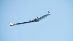
Army looks to commercialize automated photogrammetry system that can make 3D aerial maps in minutes
ALEXANDRIA, Va. – Aerial imagery is a common asset in military matters, but 3D maps can be difficult to collect on short notice without specialized equipment. This new photogrammetry technique from the Army Corps of Engineers, however, can make accurate 3D maps from ordinary aerial footage in just minutes. Tech Crunch reports. Continue reading original article
The Military & Aerospace Electronics take:
25 Nov. 2019 -- Photogrammetry compares several photos of the same location to produce a 3D map. In some cases is still relies on human intelligence to determine which frames of a video would help produce the best results.
Ricky Massaro from the Army’s Geospatial Research Laboratory in Alexandria, Va., has mitigated that problem and produced an efficient photogrammetric method that can turn aerial imagery into accurate 3D surface maps in near real time without any human oversight.
The system was tested by the 101st Airborne Division at Fort Campbell, Ky., which mapped a mock city for training exercises. It also was deployed in Iraq for non-combat purposes; it’s been put to work, and the Army is negotiating to commercialize the system.
Related: Military wearable computing hits the mainstream
Related: Sierra Nevada Corp. to provide enhanced 3D imaging for helicopter operations
John Keller, chief editor
Military & Aerospace Electronics

