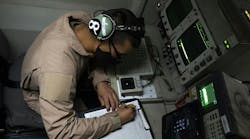
One of the largest precision aerial acquisition operations in the U.S., Photo Science owns four Leica LiDAR sensors and three Z/I Imaging large-format DMC digital mapping cameras, as well as operates a fleet of 10 single- and twin-engine aircraft deployed nationally.
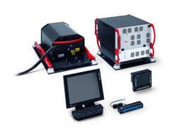
The Leica ALS70 is an airborne laser scanner with an effective 500 kHz pulse rate capability designed specifically for high-density point collection in diverse environments, which can reduce flying time up to 60 percent. The ALS70’s Point Density Multiplier technology allows for a quantum increase in measurement and scan rates over previous capabilities. The Leica ALS70-HP version purchased by Photo Science was developed for general-purpose mapping over a wide variety of terrain at different flying altitudes.
The markets for LiDAR data are maturing in two ways: First, existing applications for digital elevation data are requiring an increase in point density per square meter, which the powerful ALS70 can accommodate; second, the demand for accurate LiDAR data is now coming from new markets, including vegetation analysis and utility transmission line mapping, that require bare-earth returns in narrow corridors.
“Many LiDAR sensors on the market are designed with one application in mind, but the ALS70-HP is a true multi-purpose laser scanner developed to meet the needs of many markets,” says Jean Gardiner, general manager of Leica Geospatial Solutions. “And the ALS70-HP can be upgraded to the HA version for firms that need to perform high-altitude LiDAR collection.”


