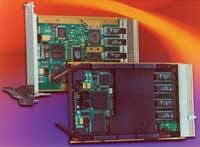
NavCom Technology Inc. in Torrance, Calif., is offering the VueStar aerial survey solution software that combines the new StarPac utility software that facilities integration into pre-existing workflows. VueStar’s global navigation system is for all aerial survey applications and uses the global satellite-based StarFire network to provide positioning information worldwide without the need for TRK base stations or GPS processing, company officials say. The 12-channel dual-frequency GPS receiver computes real-time positions as fast as 25 times per second, re-acquires GPS signals quickly, and includes troposphere modeling to compensate for changes in altitude. The StarPac mission software provides pre-mission and post-mission processing, and includes mission-planning tools, RINEX conversion, datum conversion, trajectory platting, and output of position data in several formats. For more information contact NavCom Technology online at www.navcomtech.com.
Voice your opinion!
Voice your opinion!


