Army asks for industry's help to provide COTS components for terrain imaging in command posts and vehicles

ALEXANDRIA, Va., 3 June 2012. Researchers at the U.S. Army Corps of Engineers are reaching out to the defense industry to determine interest, technology, and expertise to determine if the Army could use commercial-grade and off-the-shelf components in command posts and military vehicles to help warfighters visualize and analyze the lay of the land nearby, based on terrain data stored in computers.
Experts at the Army Core of Engineers Geospatial Center in Alexandria, Va., issued a source-sought notice (W5J9CQ-12-R-0010) last week for the Command Post (CP) and Mounted Computing Environments project to find sources of commercial off-the-shelf (COTS) components for forward-deployed terrain-imaging tools for command posts and vehicles.
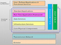
The technology for terrain visualization and analytic capabilities must be scalable, based on a standards, sharable, applicable to several kinds of missions, able to host third-party software perform on thick, thin, and web clients, provide run-time application frameworks such as toolkits, and use virtual machine infrastructures and cloud environments.
Companies interested in identifying their talents to the Army Corps of Engineers should describe their systems and geospatial capabilities; how potential solutions would work on thin or Web client, on a virtual machine or in cloud computing; hardware dependencies; technology maturity; training requirements; how proposed technology would be demonstrated; how solutions would manage geospatial data; how technology would be supported in the field; and information assurance.
Proposed solutions should work in at least near real time, display military symbology according to MIL-STD-2525B, MIL-STD-2525C, and Standard and Shareable Geospatial Foundation (SSGF). Solutions also should be able to read in several formats, including Enhanced Controlled Image Base (ECIB) and JPEG2000.
Solutions also should be able to read and display raster data in several formats, including Compressed ARC Digitized Raster Graphic (CADRG) and Enhanced Compressed Raster Graphic (ECRG), as well as be able to use Open Geospatial Consortium (OGC) Web Mapping Services (WMS), GetCapalities request to retrieve a listing of layers available, request images using the correct Coordinate Reference System (CRS). OGC Web Map Tiling Service (WMTS), Geospatially-reference Data & Information (GD&I), and OGC Web Mapping Services (WMS).
Army researchers also are interested in capabilities such as the ability to handle issues when the displayed CRS is not available from the WMS server, Keyhole Markup Language (KML) files, feature editing and symbology modification, requesting features from a OGC WFS based on location or attributes, query additional information about features on the image using the GetFeatureInfo, edit features using the WFS LockFeature, GetFeatureWithLock, and Transaction.
Other capabilities of interest include the ability to use OGC Web Feature Services (WFS), toggle which types of features are pulled from the WFS, request images using the correct CRS, convert features to the correct CRS, support unstructured data, use Geospatial JavaScript Object Notation (GeoJSON), use Geography Markup Language (GML) files, edit features, and request raster data from a OGC Web Coverage Service (WCS).
Story continues below.
E-mail responses to the Army Geospatial Center's Diane Zartman at [email protected] or Shirley A. Martin at [email protected].
Zartman's phone number is 703-428-1024, and Martin's phone number is 703-428-3610, for questions or concerns.
More information is online at https://www.fbo.gov/notices/27bb41c3eb2aebac8798647e1a375859.
Follow Military & Aerospace Electronics and Avionics Intelligence news updates on Twitter
