Army searches industry for state-of-the-art imaging LIDAR for tactical mapping from UAVs
Officials of the Army Contracting Command have issued a source-sought notice (W909MY-17-R-A006) for the LIDAR Payload for Manned and Unmanned Airborne Platforms project.
The Army Contracting Command is issuing this notice on behalf of the Army Communications-Electronics Research, Development and Engineering Center (CERDEC)-Night Vision and Electronic Sensors Directorate (NVESD) at Fort Belvoir, Va.
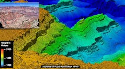
This project seeks to determine the state-of-the-art in LIDAR systems for tactical mapping, mission planning, and target detection using multi-aspect foliage penetration (FOPEN) technology. Of particular interest is LIDAR technology mature enough for an advanced technology demonstrator prototype.
Related: Four companies to develop enabling technologies for tomorrow's electro-optical lidar sensor
Army researchers are looking for LIDAR systems that consist of several line-replaceable units (LRUs) including an imaging sensor, data storage, and sensor processing.
The imaging sensor must have a pointing and stabilization unit such as a stabilized turret that houses the sensor optics, focal planes, and supporting electronics. The data storage and sensor processing has computer, data storage, sensor-processing algorithms, and imaging sensor command, control software.
Companies interest may respond separately for the imaging sensor and for the data storage and sensor processing unit. Responses to the data storage and sensor processing unit should focus on unique processing techniques and algorithms, as well as small size, weight, and power consuming (SWaP) hardware.
The LIDAR imaging sensor should offer resolution of 30 centimeters from altitudes of at least 18,000 feet above ground level, with point rates of 500,000 to 6.5 million final-product points per second. It should have a variable swath from 200 meters or less to 1 kilometer or more, with slant ranges of 25,000 feet.
Related: Navy asks Logos for enabling technologies in compact unmanned aircraft sensor payloads
Since this sensor will be mounted to an unmanned aircraft, low weight and aerodynamic drag are major concerns. Researchers want systems that weigh between 200 and 300 pounds, and that measure 18 to 21 inches in diameter.
Software should include automated feature extraction and aided target recognition algorithms for anomaly detection, segmentation, void detection, plane detection, other features to minimize analyst workload, and limited-bandwidth communications of less than 2 megabits per second.
Companies interested should email responses no later than 30 Jan. 2017 to the Army's Hanh Dinh at [email protected]. Email questions or concerns to the Army's Rosetta Wisdom-Russell at [email protected].
More information is online at https://www.fbo.gov/notices/9c604bd41de0aa4fe7213412302aa6d2.
Learn more: search the Aerospace & Defense Buyer's Guide for companies, new products, press releases, and videos
