BAE Systems to help DARPA provide intelligence analysts with satellite imagery using cloud computing
Officials of the U.S. Defense Advanced Research Projects Agency (DARPA) in Arlington, Va., announced a $2 million contract to BAE Systems last week for the Geospatial Cloud Analytics (GCA) project.
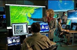
GCA seeks to create scalable computer cloud-based repository of global satellite data, make it accessible via common interfaces, and start developing analytics-as-a-service for U.S. military users.
The rapid pace of new commercial satellite constellation launches has led to a significant increase in the amount and availability of geospatial imagery, DARPA researchers point out.
Until now, however, there has been no straightforward way for analysts to access and analyze all of that imagery. Instead, today's ad-hoc, time-intensive approach requires gathering and curating data from many sources, downloading it to specific locations, and running it through separate suites of analytics tools.
The GCA program seeks to enable instant access to the most up-to-date images anywhere in the world, as well as cutting-edge analysis tools by aggregating vast amounts of commercial and open-source satellite data from optical and RF sensors, as well as from synthetic aperture radar (SAR).
BAE Systems experts will try to do this virtually in a common cloud-based repository with automated curation tools that would provide global situational awareness, event detection, monitoring, and tracking capabilities. The project also aims to create analytical applications to enable analysts to draw specific information from the aggregated data.
GCA will carry out an analytical services business model where commercial entities offer analytics services and applications via a competitive marketplace.
“The goal of GCA is to provide a secure cloud-based platform that automatically curates multi-source global data and metadata, allowing analysts to focus their attention and expertise on analysis -- not data collection, aggregation, and curation,” says Joe Evans, DARPA's GCA program manager.
The idea is to enable commercial analytics providers to use the common data platform to develop and offer their services in a competitive market that would provide image analysis to the U.S. military at an affordable price.
In this project, BAE Systems experts will look at problems at a variety of time scales, such as food shortages over a period of weeks or months; locating oil fracking sites or days and weeks; detecting illegal fishing over minutes to days; and an open-call scenario where proposers may suggest other problems of military relevance.
For more information contact BAE Systems Electronic Systems online at www.baesystems.com, or DARPA at www.darpa.mil.
Ready to make a purchase? Search the Intelligent Aerospace Buyer's Guide for companies, new products, press releases, and videos
