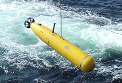
DARPA approaches industry for new kinds of underwater navigation for undersea drones and submarines
Officials of the U.S. Defense Advanced Research Projects Agency (DARPA) in Arlington, Va., on Thursday released a broad agency announcement (DARPA-BAA-15-30 for the Positioning System for Deep Ocean Navigation (POSYDON) project.
POSYDON seeks to develop an undersea system that provides omnipresent, robust positioning, navigation, and timing independently of GPS and inertial navigation.
The problem is that GPS satellite navigation signals can't penetrate through water and so are useless to submerged vehicles, unless these undersea vehicles surface from time to time to take a GPS fix. Surfacing leaves them vulnerable to detection.
Inertial measurement units, while effective, lose their accuracy over time, and so need to correct themselves with GPS fixes once in a while, which requires the undersea vehicles to surface.
DARPA experts say they envision a small number of acoustic sources, analogous to GPS satellites, around an ocean basin. By measuring the absolute range to several source signals, an undersea platform can obtain continuous, accurate positioning without surfacing for a GPS fix.
POSYDON seeks to eliminate the need for expensive IMU and velocity sensors. Host vehicles of interest include UUVs of all types, although DARPA also encourages solutions that other undersea vehicles and systems could use. POSYDON will not require the vessel to surface to obtain and maintain its positioning, navigation, and timing information, and the vessel will not need to make any RF transmissions, thus maintaining minimum vessel detectability.
DARPA intends that execution of the POSYDON program obey all applicable laws and regulations protecting marine life, including Executive Order 12114, Endangered Species Act, and Marine Mammal Protection Act.
Related: Precise underwater navigation with sonar is aim of Navy research contract to Penn State
DARPA researchers are interested in positioning, navigation, and timing technologies that are available for the deep ocean, over continental shelves, and in shallow coastal waters and harbors, while being immune-by-design to attempts to jam or disrupt its navigational capabilities.
POSYDON will involve acoustic measurement modeling, acoustic source and waveforms, at-sea data collection and demonstration, and optional adjunct technologies.
Acoustic measurement modeling involves underwater acoustic signal propagation channels that can overcome challenges in time-varying multipath propagation and multipath delay; Doppler spread due to vessel motion relative to the acoustic source(s) and ocean environment; bandwidth-limited signals; and convergence zones.
Acoustic source and waveforms involves finding an acoustic source and determine the number, location, and depth of the sources for basin-scale coverage. At-sea data collection and demonstration, meanwhile, involves at-sea data collection to validate acoustic measurement modeling and acoustic source and waveforms.
Related: NATO minehunting UUV relies on GPU-based embedded processor from GE for imaging sonar
Adjunct technologies could involve stand-alone positioning, navigation, and timing solutions that involve other kinds of component, processing, or modeling approaches. Several contract awards are possible, depending on the quality of proposals and availability of money.
Companies interested should upload abstracts no later than 7 May 2015 online at https://baa.darpa.mil. Full proposals are due no later than 11 June 2015 online at https://baa.darpa.mil.
Email questions or concerns to DARPA At [email protected]. More information is online at https://www.fbo.gov/spg/ODA/DARPA/CMO/DARPA-BAA-15-30/listing.html.
