IARPA presents ideas to industry for data fusion in multispectral imaging for intelligence analysis
Officials of the U.S. Intelligence Advanced Projects Agency (IARPA) in Washington issued a draft broad agency announcement on Friday (IARPA-BAA-19-04) for the Space-based Machine Automated Recognition Technique (SMART) project.
SMART will rely on geographical information from satellite cameras, and develop multi–spectral and multi–temporal sensor processing to overlay data from infrared and multispectral sensors to make the intelligence analyst's job easier.
Many space and airborne sensors today can provide imagery suitable for geographical intelligence (GEOINT). SMART will demonstrate that GEOINT gleaned through data fusion is greater than the simple sum of GEOINT gleaned from several images analyzed in the absence of other imagery.
The idea is to reduce uncertainties inherent in single-sensor data, and reduce the sheer amount of intelligence imagery data that can overwhelm intelligence analysts by developing tools to help analysts analyze intelligence imagery using Big Data, IARPA officials say.
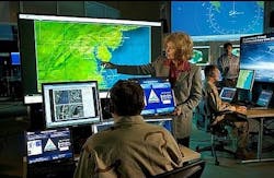
The volume of GEOINT data continues to grow, while analysts struggle with the volume, variety, and velocity of space-based data. IARPA is seeking automated broad-area search, monitoring, and analysis of man-made activities based on data fusion of spectral and temporal space-based imagery.
While one sensor may have resolution sufficient to detect changes and man-made disturbances, intelligence experts still struggle with the inability to analyze images over time because of infrequent satellite orbits or weather cover.
IARPA experts want to push the technology state of the art in high-performance analytics that scales to extremely large data sets; data mining, ranking and visualization; and image analyst tools like automated broad-area search of man-made processes.
Related: Multi-sensor fusion hits the mainstream
By blending data from several different electro-optical sensors, IARPA experts want to improve the ability to detect and monitor man-made disturbances to track the progress of major construction projects.
The program will focus on five research thrusts: detecting man-made disturbances by blending data from military, government, and commercial satellites; apply machine learning to improve imagery data from medium-resolution imaging satellites; improve change detection accuracy; use SMART technology in intelligence gathering; and reduce uncertainties in data fusion.
IARPA would like companies that are interested to review program details, available online in .pdf form, at https://www.fbo.gov/utils/view?id=4c6cf7adf5e84179ec5bdbf392a3d03a, and email comments, questions, suggested changes, and feedback no later than 10 May 2019 to [email protected].
More information is online at https://www.fbo.gov/notices/7dfd4ff68f5ece7c52871d91e05889ff.
Ready to make a purchase? Search the Military & Aerospace Electronics Buyer's Guide for companies, new products, press releases, and videos
