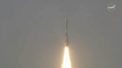
India launches first-of-its-kind L- and S-band observation satellite for NASA-ISRO
BENGALURU, India - - India launched on Wednesday a $1.5 billion, first-of-its-kind radar imaging satellite built in collaboration with NASA, deploying it to help enhance global monitoring of climate change and natural disasters.
The NASA-ISRO Synthetic Aperture Radar, or NISAR satellite, is the first such collaboration between the Indian Space Research Organisation and U.S. space agency NASA, Nivedita Bhattacharjee reports for Reuters. Continue reading original article.
The Military & Aerospace Electronics take:
31 July 2025 - The NASA-ISRO Synthetic Aperture Radar (NISAR) satellite is the first free-flying mission to carry both L-band and S-band radar systems. Each radar operates at different wavelengths and provides complementary data: the L-band is ideal for tracking soil moisture, forest biomass, and ground or ice movement, while the S-band is suited to monitoring agriculture, grasslands, and infrastructure shifts. Together, they offer more comprehensive Earth observation than previous SAR missions and can operate through cloud cover and darkness.
NASA is supplying the L-band radar and other key systems including the antenna reflector, communications, GPS, and data handling. ISRO is contributing the S-band radar, spacecraft bus, launch vehicle, mission operations, and ground data systems. This mission represents a fully collaborative partnership between the U.S. and India, aiming to support global research in agriculture, forestry, climate change, and disaster management.
“ISRO’s GSLV has precisely injected NISAR satellite into the intended orbit, 747 kilometers. I am happy to inform that this is GSLV’s first mission to Sun-synchronous polar orbit. With this successful launch, we are at the threshold of fulfilling the immense scientific potential NASA and ISRO envisioned for the NISAR mission more than 10 years ago,” said ISRO Chairman V Narayanan. “The powerful capability of this radar mission will help us study Earth’s dynamic land and ice surfaces in greater detail than ever before.”
Related: ICEYE launches two SAR satellites, expanding Earth observation capabilities
Related: High-altitude aircraft use NASA sensors to hunt for minerals
Jamie Whitney, Senior Editor
Military + Aerospace Electronics
