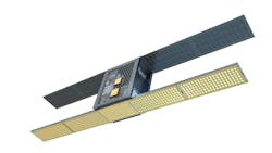
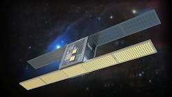
Iceye raises millions to launch first radar-based microsatellites
HELSINKI, Finland, 13 Nov. 2015. Iceye, a space technology startup in Helsinki, Finland, has secured more than $5 million in funding to help launch radar-based microsatellites designed to deliver earth imagery for disaster relief, logistics, planetary exploration, agriculture, nature, and climate applications.
“The ICEYE system is unique because we do not rely on traditional optical imaging technology. Unlike camera technology, our radar is not limited by the same requirements – it’s capable of viewing through cloud cover, bad weather, and darkness, providing unlimited access wherever it’s needed,” says Iceye CEO/Co-founder Rafal Modrzewski. “The timeliness of the imaging service is always limited by the speed of access to the target site. We’ve applied miniaturization and industrial manufacturing to the field of radar imaging. This allows us to launch not just one, but tens of satellites and ultimately reduce the response times from days to minutes. We believe this breakthrough in earth imaging is going to have a real positive impact on the world."
To date, Iceye has raised $2.8 million in Series A funding and €2.5 million in research & development (R&D) funding within EU Horizon 2020.
Iceye provides quick-response imagery from space with microsatellites equipped with imaging radar technology. The Iceye instrument can see through clouds, obscuring weather, and in the dark-all conditions that limit camera-based services in situations where waiting for daylight and nice weather is not an option.
Iceye's imaging radar instrument allows the company to supply unique, near-real-time imagery globally, with groups of small satellites. With the radar instrument, the satellites can acquire images regardless of weather or daylight conditions, so the information will be available even in situations where camera-based satellites cannot see the target. This new reliable data source is needed not only by industries such as logistics, insurance, and energy, but also by organizations monitoring climate and environment, or providing search and rescue services.
"Just last week, we were in Greece to help the aid organizations. They are struggling to rescue the refugees crossing the bay to Lesvos in their overcrowded boats," Modrzewski says. "We brought ground-based radars to track the vessels and they were game-changing to the rescue operation-but their range is limited. The order-to-delivery time for commercially available satellite imagery is around a week, which doesn't help if the boats can capsize and disappear in minutes. That's why we are working hard every day to get our own service up and running."
"Governmental and military operators own and use radar satellites already," says Pekka Laurila, co-founder and CFO. "We want to make this technology accessible to everyone at a commercially feasible cost level, which means reducing the satellite unit prices over 100-fold compared to traditional satellites. One of the ways we achieve this is by utilizing off-the-shelf mobile electronics and mass manufacturing."
"The need and opportunity for Iceye's satellites are enormous," explains Jyri Engeström, member of the investment team at True Ventures. "From forest fires, to floods, to search and rescue operations, to agricultural uses, Iceye will be able to provide critical real-time information that today's technology cannot. The market for this product is real and we believe this is the team to lead it."
Iceye is building a satellite-based information service, providing the world with access to near-real-time imagery from space. The Iceye imaging radar instrument can image through clouds, obscuring weather and darkness, making the system more reliable for operational use than camera-based systems.
You might also like:
Subscribe today to receive all the latest aerospace technology and engineering news, delivered directly to your e-mail inbox twice a week (Tuesdays and Thursdays). Sign upfor your free subscription to the Intelligent Inbox e-newsletter at http://www.intelligent-aerospace.com/subscribe.html.
Connect with Intelligent Aerospace on social media: Twitter (@IntelligentAero), LinkedIn,Google+, and Instagram.


