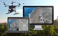
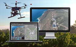
Drone2Map 1.0 for ArcGIS provides in-field rapid image processing for UAS operators
REDLANDS, Calif., 30 June 2016. Esri is introducing Drone2Map for ArcGIS, a desktop app that processes images from unmanned aircraft systems (UAS), also known as drones, to quickly create imagery products for mapping, analysis, and sharing across the ArcGIS platform.
"Processing imagery used to be complicated and take days or even weeks. Now it can be done on the fly. By adding imagery to a map, people gain that next level of situational awareness," says Lawrie Jordan, director of imagery at Esri. “Novices and experts alike can use Drone2Map to process still imagery captured by drones and use that imagery right away.”
Drone2Map offers in-field rapid image processing that enables the pilot to confirm that the UAS flight has captured imagery of the full area of interest, reducing the need for costly return trips to the field. The app detects camera and sensor parameters, then intelligently applies appropriate defaults. The photogrammetry engine in Drone2Map is powered by Pix4D, an industry leader in professional image processing software.
During its beta program, Drone2Map proved to be a reliable, affordable, and effective solution for performing land analysis and infrastructure inspection and monitoring events such as natural disasters or environmental changes.
"Drones can travel places that may be dangerous for people, and they prove a more affordable alternative to conventional means of image capture," Jordan says. "With Drone2Map, on-demand imagery can be used in ArcGIS to provide a clear, accurate picture of any asset or area."
With this release of Drone2Map, users will be able to
- Create orthomosaics, 3D meshes, and more.
- Build products with 2D and 3D mapping templates.
- Make scene layer packages from textured meshes and share them as a scene layer.
- Toggle between 2D and 3D views.
- Work offline in a disconnected environment.
- Register multiple portals for adding and sharing content.
- Download a portion of a basemap for offline use.
- Import and create ground control points for data accuracy.
Since 1969, Esri has been giving customers around the world the power to think and plan geographically. As the market leader in GIS technology, Esri software is used in more than 350,000 organizations worldwide including each of the 200 largest cities in the United States, most national governments, more than two-thirds of Fortune 500 companies, and more than 7,000 colleges and universities. Esri applications, running on more than one million desktops and thousands of web and enterprise servers, provide the backbone for the world's mapping and spatial analysis. Esri is the only vendor that provides complete technical solutions for desktop, mobile, server, and Internet platforms.
Search the Aerospace & Defense Buyer's Guide
You might also like:
Subscribe today to receive all the latest aerospace technology and engineering news, delivered directly to your e-mail inbox twice a week (Tuesdays and Thursdays). Sign upfor your free subscription to the Intelligent Inbox e-newsletter at http://www.intelligent-aerospace.com/subscribe.html.
Connect with Intelligent Aerospace on social media: Twitter (@IntelligentAero), LinkedIn,Google+, and Instagram.
Intelligent Aerospace
Global Aerospace Technology NetworkIntelligent Aerospace, the global aerospace technology network, reports on the latest tools, technologies, and trends of vital importance to aerospace professionals involved in air traffic control, airport operations, satellites and space, and commercial and military avionics on fixed-wing, rotor-wing, and unmanned aircraft throughout the world.


