Boundless expands open-source geographic information system platform with Desktop, Connect
In response to market demand for more open and scalable GIS solutions, Boundless extended its GIS platform with:
- Boundless Connect, a subscription service to a comprehensive repository of GIS data, and
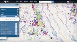
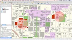
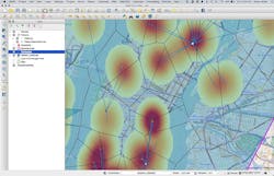
- Boundless Desktop, a full-featured, professional desktop GIS, bringing a powerful ecosystem of geospatial knowledge, tools, and resources to the enterprise.
“With the launch of Boundless Connect and Boundless Desktop, we have taken a major step forward in delivering the most complete, commercially supported open GIS platform,” Boundless CEO Andy Dearing explains. “As the need for an alternative to costly, closed GIS systems grows, Boundless is proud to partner with the open-source community to provide new tools and open solutions that foster growth of the largest repository of the world’s geospatial knowledge and resources.”
Boundless offers an open GIS ecosystem through a unique combination of technology, products, and experts that gives enterprises deeper intelligence and insights using location-based data. The Boundless platform is built upon open-source technology and open application program interfaces (APIs) that generate actionable location intelligence across third-party apps, content services, and plug-ins for enterprise applications.
Manage and exploit the value of geospatial or geographical data
Eighty percent of today’s data includes a location component. Proprietary, licensed solutions can be prohibitively expensive for the growing volume of geospatial data. Making the world of geospatial data available to virtually any user, Boundless is open by design, immediately scalable, and license-free and enables developers, GIS, and business analysts to access location-based data in a cloud-based GIS platform.
According to P&S Market Research, theglobal geographic information system (GIS) market is expected to to reach $14.6 billion by 2020, growing at a compound annual growth rate (CAGR) of 11.4 percent. Additionally, the U.S. Department of Labor named geospatial technology one of the top three most important high-growth industries in the 21st century, along with nanotechnology and biotechnology.
Boundless, an open GIS platform for government and commercial mapping and analytics, includes Exchange, Suite, Desktop, and Connect. The company also offers packaging, support, maintenance, professional services, and expert training to help reduce the cost and time of deploying and managing geospatial software, officials explain.
Features and benefits of the Boundless open GIS platform include:
- a comprehensive product line of commercially supported open GIS products including Desktop, Suite, and Exchange;
- an ecosystem of geospatial tools, content, and services; and
- 14 years of open-source expertise with GIS resources including consulting, training, and support.
Boundless is operational in government and commercial environments, with customers that include: National Oceanic and Atmospheric Administration (NOAA), Port of Seattle, Louisiana Department of Health and Hospitals, and TriMet.
"As many government agencies across the country experience, funding for new technology can be challenging to secure. In Louisiana, which experiences more than its share of disasters, mapping of facilities and threats is a critical deliverable from our emergency preparedness group, with demand for such information spiking during actual emergencies,” explains Henry Yennie, program monitor, emergency preparedness, Louisiana Department of Health. “With Boundless, we’ve been able to cost-effectively leverage our existing databases with the ease and power of a web interface based on Boundless Exchange — achieving real-time visibility during the entire lifecycle of an emergency. The platform has been reliable and scalable and we consider this application suite to be the ‘hidden jewel’ in a market crowded with complex, expensive GIS products."
“Leveraging open-source technology supplemented with enterprise support from Boundless, we have secured the assurance we needed to proceed with our development ambitions while minimizing risk for the enterprise,” says Eric Drenckpohl, enterprise GIS manager, Port of Seattle. “Not only does the platform perform exceptionally well, but the ability to work in a hybrid environment and embrace open source software alongside our existing investments has also allowed for the scalability, flexibility and agility our organization needs.”
Helping to advance open GIS, Boundless is an active leader in the open source community, working with partners, customers, and developers worldwide. Boundless gives customers direct access to the open source community for the ability to provide feedback and influence future direction. The company is committed to open source and all of the projects it works with are published using theOpen Source Initiative approved license.
The Boundless open GIS platform includes Exchange, Suite, Desktop, and Connect. The new Boundless Desktop and Boundless Connect are available immediately. Subscription pricing for support and maintenance of the Boundless product stack starts as low as $5 per month. For more information and additional pricing details, e-mail [email protected].
Boundless is a leader in open GIS (geographic information systems). Unlike proprietary, licensed solutions, Boundless opens the world of geospatial data to any user. The experts at Boundless reduce the cost and time of deploying and managing geospatial software with a scalable, open GIS platform - including Exchange, Suite, Desktop, and Connect - and a powerful ecosystem of geospatial knowledge, tools and resources. Learn more atboundlessgeo.com. Join the GIS community at https://connect.boundlessgeo.com/. Follow Boundless@boundlessgeo.
Search the Aerospace & Defense Buyer's Guide
You might also like:
Subscribe today to receive all the latest aerospace technology and engineering news, delivered directly to your e-mail inbox twice a week (Tuesdays and Thursdays). Sign upfor your free subscription to the Intelligent Inbox e-newsletter at http://www.intelligent-aerospace.com/subscribe.html.
Connect with Intelligent Aerospace on social media: Twitter (@IntelligentAero), LinkedIn,Google+, and Instagram.
Intelligent Aerospace
Global Aerospace Technology NetworkIntelligent Aerospace, the global aerospace technology network, reports on the latest tools, technologies, and trends of vital importance to aerospace professionals involved in air traffic control, airport operations, satellites and space, and commercial and military avionics on fixed-wing, rotor-wing, and unmanned aircraft throughout the world.


