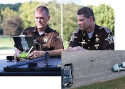
Drones shown to make traffic crash site assessments safer, faster and more accurate
“Our procedure for data collection using a drone can map a scene in five to eight minutes, allowing public safety officers to open the roads much quicker after an accident,” says Ayman Habib, a professor of civil engineering, who developed the photogrammetric procedures and envisions even more uses for the technology, reports Cynthia Sequin for Futurity. Continue reading original article
The Intelligent Aerospace take:
February 8-Perdue University's research into the use of UAVs to map the scene of automobile accidents shows that drones and 3D printers can produce faster and more accurate assessments than "boots on the ground." In Tippecanoe County, Indiana, its sherriff's office used a UAV system 20 times in 2018. Captain Robert Hainje of the Tippecanoe County Sheriff’s Office says that the drone can cut the slowed traffic flow near the crash site down by 60% compared to traditional investigations. That's good news for motorists and people on the scene because secondary crashes caused by drivers unaware that traffic has slowed or stopped can cause further injuries and damaged property.
Related: Swedish group says UAS solutions will help automate daily operations in airports
Jamie Whitney, Associate Editor
Intelligent Aerospace
Ready to make a purchase? Search the Intelligent Aerospace Buyer's Guide for companies, new products, press releases, and videos
