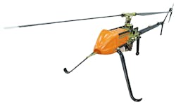
UAVOS and Polynesian Exploration team up for autonomous solutions for 3-D mapping
LAS VEGAS - UAVOS Inc, in conjunction with the maker of the POLYSCANNER Aerial 3D Mapping and Surveying system Polynesian Navigation, Inc., has announced the partnership in providing a long-distance autonomous solution for 3D mapping.
The light unmanned helicopter UVH -25EL powered by UAVOS's autopilot is a platform for a long-distance autonomous solution for 3D mapping. The UVH-25EL has increased performance with a carrying capacity, a flying range, and an extended temperature range. Take-off and landing as well as missions are carried out automatically.
The POLYSCANNER is an integrated payload solution for Aerial HD Mapping and Surveying. The system features a choice of LiDAR’s, a global shutter camera and dual frequency RTK GNSS/INS with centimeter-level accuracy, as well as a high level of integration and sensor fusion software. The system is capable of creating accurate colorized 3D models in a point cloud format.
