Raytheon to develop algorithms and sensor network for DARPA testbed focused on combat airspace management
ARLINGTON, Va. – U.S. military researchers are looking to Raytheon Technologies Corp. to help develop a virtual and live testbed for combat airspace management.
Officials of the U.S. Defense Advanced Research Projects Agency (DARPA) in Arlington, Va., announced an $7.6 million contract last Wednesday to the Raytheon Intelligence & Space segment in Tewksbury, Mass., as part of the Air Space Total Awareness for Rapid Tactical Execution (ASTARTE) program.
Raytheon experts will develop the Airspace TacticaL Automation System (ATLAS) for the ASTARTE program. Raytheon will develop and demonstrate a virtual and live testbed for airspace management systems, algorithms for airspace planning and operations, and a sensor network for real-time spatial and temporal tracking of manned and unmanned aircraft.
Raytheon joins Systems & Technology Research LLC (STR) in Woburn, Mass., on the ASTARTE program. STR won an $8.3 million ASTARTE contract last month.
Raytheon engineers will develop a virtual lab testbed to help model, simulate, and virtualize current joint military airspace management systems with interfaces to connect real-world hardware and software in a common software framework that supports virtual and real-world environments.
The overall ASTARTE program seeks to provide real-time, low-risk joint deconfliction between airspace users and joint fires at an Army division-level to enable responsive support to tactical units and build a resilient air picture in an anti-access/area denial (A2/AD) environment while conducting joint all-domain command and control (JADC2) operations.
ASTARTE enabling technologies will handle sensor tasking, data processing, multi-modal data fusion, and near-real time dissemination to enable dynamic spatial and temporal airspace management and operations.
The ASTARTE program has three parts. First is understanding and decision algorithms that identify and predict airspace usage conflicts, determine restricted operating zones, propose alternative airspace de-confliction courses of action with assessed risk levels, and dynamically planning and tasking sensors to create an airspace picture.
Related: What 5G means to the military
Second, the project will develop sensors that in real time can detect and track manned and unmanned aircraft, missiles in-flight, unmanned balloons, and other potential flight hazards.
Third is a virtual lab testbed that enables modeling, simulation, and virtualization of military airspace management systems, and connects to connect real-world hardware.
The current approach to airspace planning and control predominately involves manual and static procedures that allocate lanes and zones over the battlefield, which can prohibit adaptive re-tasking and reapportionment.
This approach also can be over-previsioned to provide any flexibility, but can cause very inefficient use of available airspace, causing slow or inaccurate coordination between fires and airspace users, which allows an adversary to fire and maneuver unchallenged.
Prior attempts to create a more dynamic, joint picture of the airspace relied on an overly complex and burdensome centralized approach that attempted to force all operations, data, command, and control into a common framework.
Instead, ASTARTE seeks to gather data, form a refined airspace picture, and re-plan by exception as necessary to support dynamic joint-service operations.
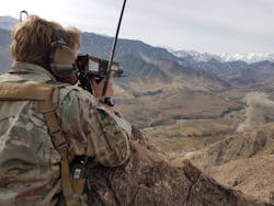
ASTARTE focuses on the most challenging airspace problem: the airspace above an Army division under battlefield airspace that measures about 360 square miles, and extends from the ground to about 18,000 feet in altitude.
This area contains Army, Air Force, Navy, Marine Corps, Special Operations, allied, and enemy manned and unmanned aircraft and munitions passing through the airspace. It also contains forces conducting fire missions and close air support. The airspace also may include commercial aircraft and other hazards.
Related: U.S. Marine Corp chooses General Dynamics team to create new aviation subsystems
Still, the system must be aware of adjacent air spaces and the airspace above the division airspace to include high-altitude aircraft, satellites and manned spacecraft.
On this first phase of the ASTARTE program, Raytheon will do the work in Tewksbury and Cambridge, Mass; Cedar Rapids, Iowa; Fulton, Md.; Dulles, Va.; and Durham, N.C., and should be finished by February 2022.
For more information contact Raytheon Intelligence & Space online at www.rtx.com, Systems & Technology Research at www.stresearch.com, or DARPA at www.darpa.mil.
