Sailors map the battlespace with unmanned underwater vehicles
By Ben Ames
U.S. Navy sailors prepare precise maps of the ocean around them while preparing for sea battles. Despite this preparation, once the fighting begins, they still must constantly search for underwater mines.
One of the most crucial tools for both jobs is an Unmanned Underwater Vehicle (UUV). During exercises like the series of Fleet Battle Experiments, they use UUVs to collect data such as bathymetry (depth maps) and bottom classifications, using sonar sensors.
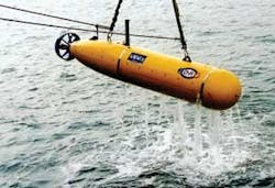
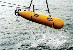
One tool they use is the Bluefin-21 BPAUV, from Bluefin Robotics Corp. in Cambridge, Mass.
Bluefin engineers call their craft an autonomous underwater vehicle (AUV), because it navigates and operates under its own power, without a tow line from the mother ship. That keeps sailors safer because the AUV can venture into more dangerous waters, and it lets the vehicle maneuver through much tighter spaces-the turning radius for an AUV is measured in meters, compared to kilometers for a towed UUV.
Useful for oceanography and oil surveying as well as military exercises, the vehicles range from diameters of 21 inches down to 12 and nine inches. The length of each AUV varies from one to five meters, depending on how many sensors it carries. The final variable is depth-Bluefin AUVs can dive from the surface to depths of 300 meters to 4,500 meters.
In a typical mission using the BPAUV for battlespace preparation (the “BP” in its name), sailors begin by programming the tasks into the vehicle’s software.
Once they are ready to launch, they can use a vessel as small as 40 feet long. Bluefin designers kept this AUV small; 130 inches long.
With fresh batteries, the vehicle can undertake an 18-hour mission, traveling at three knots while it uses sonar to cover 150-meter swathes at depths to 200 meters. Sailors can also use it to find mines, covering up to eight square nautical miles per dive.
The vehicle does its own navigation, and surfaces occasionally to update its position with the Global Positioning System. In its standard configuration the Bluefin-21 carries 455-kHz sidescan sonar that provides a 10-centimeter resolution along track and a 7.5-centimeter resolution across track. Other common sensors include velocity, current, conductivity and temperature, inertial navigation, attitude heading, depth, and GPS.
In the future, sailors and scientists will collect data even faster and cheaper by operating several AUVs from a single vessel, Bluefin leaders say. And with improvements in navigation, control, and power supplies, they will one day dispense with vessels altogether, simply launching AUVs from the shore. For more information see www.bluefinrobotics.com.

