ESA's Biomass satellite measures Earth's 'lung capacity' from space
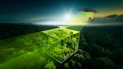
COLOGNE, Germany - Forests cover 40.6 million square kilometers of our planet – almost a third of Earth' s ice-free land area. Often called the 'green lungs' of our planet, they supply our atmosphere with fresh oxygen. But how healthy is this vital organ of our Earth? Can it continue supplying us with enough fresh air to keep Earth's ecosystems functioning? To answer these questions, we must first determine the lung capacity of our forests. This is the task of the Biomass mission, the German Aerospace Center (DLR) reports.
Continue reading original article.
The Military & Aerospace Electronics take:
6 May 2025 - “Forests are the green lungs of our planet," says Walther Pelzer, Executive Board Member of the German Aerospace Center (Deutsches Zentrum für Luft- und Raumfahrt; DLR) and Director General of the German Space Agency at DLR. "So far, however, we have only been able to estimate the amount of forest biomass worldwide. The European Biomass mission will, for the first time, determine the volume of this important carbon store with unprecedented precision and provide a detailed picture of the health of our forests – an essential step to accurately calculate global warming, predict the consequences of climate change, and take effective countermeasures. At the heart of this mission is a radar instrument developed and manufactured in Germany – further proof of our global leadership in radar technology."
The Biomass mission, the first satellite to use P-band radar, faced several scientific and technical hurdles due to the frequency’s ability to penetrate dense forests and detect large vegetation structures. Germany’s DLR Microwaves and Radar Institute supported the mission from its early stages, contributing SAR technology expertise and overseeing the development and validation of data products related to forest height and changes over time. DLR also led critical flight campaigns, including two in Gabon, using its airborne radar system and Dornier DO 228-212 research aircraft. These campaigns, conducted in collaboration with ESA, provided tomographic datasets and helped validate the algorithms essential for generating Biomass's geophysical products.
Related: Keeping a watchful eye on Earth observation and weather forecasting
Related: Successful deployment of giant reflector for forest monitoring satellite Biomass
Jamie Whitney, Senior Editor
Military + Aerospace Electronics
