ANRA Technologies tapped by Raytheon to help integrate uncrewed aircraft in national airspace
WASHINGTON - Raytheon Intelligence & Space (RI&S) sought support simulation and live drone flight operations technology. They found their solution from ANRA Technologies in Tartu, Estonia.
ANRA's SmartSkies suite of technology solutions will be put in use at the Mid-Atlantic Aviation Partnership UAS test site at Virginia Tech. The testing is part of a larger project to safely integrate uncrewed aircraft systems (UAS) into the National Airspace System and advance beyond visual line of sight (BVLOS) operations.
Under the contract, RI&S will establish a ground-based surveillance supplemental data service provider (SDSP) test program consisting of local radar services using the company’s Skyler active electronically scanned array, AESA, UAS weather product services and UAS service suppliers.
ANRA Technologies will partner with RI&S and other program participants, including Virginia Tech, SkyGrid and Tomorrow.io, to test technologies that will support scalable, safe and compliant BVLOS drone operations at low altitudes.
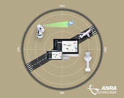
ANRA will implement its SmartSkies airspace management and data services platform to gather detailed and comprehensive SDSP data to provide a holistic operating approach as the nation moves forward to create a safe and reliable environment for UAS and Urban Air Mobility.
For this project, ANRA SmartSkies FUSION will consume data feeds from the Skyler AESA and data transmitted from cooperative aircraft flying within the USS network to develop a well-defined and known airspace environment.
SmartSkies FUSION leverages artificial intelligence and machine learning to generate a path-prediction capability to forecast into the future where aircraft will be positioned. SmartSkies CTR, in turn, enables the ability to aggregate and integrate networked and non-networked surveillance data with UTM, creating a complete airspace picture that can be distributed to authorized users. SmartSkies AWARE will integrate the Tomorrow.io weather intelligence platform into the system for flight planning and route optimization and other supplementary datasets already available in the system.
