Why turbulence is still difficult to predict
Key Highlights
- Turbulence can be caused by weather systems, mountain waves, and wind shear, often occurring without visible signs in clear skies.
- Weather radar is effective for detecting storms but less so for clear-air turbulence, which requires advanced forecasting models and pilot reports.
- Modern tools like the FAA's GTG and nowcasting systems combine observations and models to provide more immediate turbulence information.
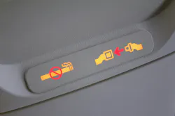
NASHUA, N.H. — The seat belt sign is off, and drinks are on the tray tables. Outside the window, the sky looks perfectly clear. Then the airplane drops. For passengers, unexpected turbulence can seem to come from nowhere. In some cases, that's not far from the truth. Pilots have weather radar, forecasts, and reports from aircraft ahead of them, but the atmosphere doesn't always give an obvious warning before the ride gets rough.
Turbulence really doesn't have just one cause. Thunderstorms can disturb the air, mountains can create waves downwind, and changes in wind speed and direction can produce turbulence at altitude. Some rough air forms around weather that pilots can see and avoid. Other turbulence develops in apparently clear skies.
That last category, known as clear-air turbulence (CAT), presents one of aviation's more stubborn forecasting problems.
Technology is getting better at finding turbulence, but predicting exactly where it will develop, how strong it will become, and whether it will still be there when an aircraft arrives remains difficult.
Related: Honeywell weather radar to equip Omni Taxi Aereo's AW139 helicopter fleet
Weather radar can see storms, not every bump ahead
Airborne weather radar gives pilots a good look at conditions along their route, but it isn't a camera pointed at the atmosphere. The radar sends out radio-frequency energy and measures what returns. Rain and other forms of precipitation produce useful reflections, allowing the system to show pilots where potentially hazardous weather lies ahead.
That makes radar particularly useful around thunderstorms. Strong convective weather can produce severe turbulence, and pilots can use radar information to avoid the cells associated with it. Clear-air turbulence, on the other hand, is much harder for radar to reveal.
There may be no heavy precipitation or obvious cloud formation for radar to detect. The sky ahead can look harmless while differences in wind speed and direction create unstable air at cruising altitude.
That means an empty-looking radar display doesn't necessarily promise a smooth ride.
Clear-air turbulence hides in otherwise ordinary skies
Jet streams play an important role in the problem. These narrow bands of fast-moving air sit high in the atmosphere, right around the altitudes where commercial aircraft spend much of their time. Differences in wind speed around the edges of a jet stream can create wind shear. Under the right conditions, that shear can break smooth airflow into turbulent motion.
The disturbance may take up a relatively small area compared with the weather systems around it. It can also change as the atmosphere evolves. Pilots can't simply look out the window and spot it. Unlike a towering thunderstorm, clear-air turbulence may have no visible boundary telling a flight crew where the rough air begins or ends.
Forecasting systems instead have to infer where the atmosphere is likely to produce it.
Forecasts look for the ingredients
Modern forecasting tools use numerical weather models to look at atmospheric conditions associated with turbulent air. Those models can identify areas where wind shear, mountain waves, and other conditions boost the likelihood of turbulence.
The Federal Aviation Administration's Graphical Turbulence Guidance (GTG), for example, combines several turbulence algorithms with weather-model data and observations. The system compares those predictions with reports of actual conditions before producing a forecast in terms of eddy dissipation rate (EDR).
EDR gives aviation a standardized way to describe the intensity of turbulence in the atmosphere rather than relying entirely on how rough the ride felt aboard a particular aircraft. Still, a forecast represents a prediction, not a map of every turbulent pocket in the sky.
Atmospheric models divide a huge, continuously changing environment into manageable pieces. Turbulence can develop at scales smaller than those models can resolve directly. A forecast may correctly identify a region with a higher chance of turbulence without pinpointing exactly where one aircraft will encounter it.
Aircraft help fill in the gaps
Some of the most useful turbulence information comes from airplanes already flying through it. For decades, aviation has relied on pilot reports, or PIREPs, to warn other crews about conditions along a route. A pilot who encounters rough air can report its location, altitude, and intensity, giving crews behind them information they didn't have before.
The system has an obvious limitation…somebody usually has to encounter the turbulence first. Pilot reports can also be subjective. The same atmospheric conditions may feel different depending on the aircraft, and descriptions such as light or moderate turbulence depend partly on how a particular airplane responds.
Automated measurements are helping remove some of that uncertainty. Aircraft can calculate EDR using information already collected by onboard systems. Those measurements provide a more consistent picture of atmospheric turbulence across different aircraft types and can be shared with forecasting systems.
The more observations available, the better forecasters can compare predictions with what's actually happening in the sky.
Turbulence forecasts are becoming more immediate
Traditional weather forecasting helps airlines plan routes before departure and make adjustments during flight. Turbulence, however, can change quickly enough that aviation also needs a picture of what is happening right now. That has pushed development toward turbulence nowcasting.
The FAA's Graphical Turbulence Guidance Nowcast blends recent aircraft observations and ground-based radar estimates with short-term forecasts. The beta system updates every 15 minutes, giving airlines a more current view of turbulent conditions across the continental United States.
Ground radar can offer another piece of the picture. The NEXRAD Turbulence Detection Algorithm estimates turbulence inside clouds using radar measurements and provides updated observations across the country.
No single source has to solve the entire problem. Forecast models can show where turbulence is likely, while aircraft can report where they encounter it and radar can provide information about turbulence associated with clouds. A nowcast can combine those observations with the latest prediction. Each new measurement lessens some of the uncertainty left by the others.
Could aircraft eventually detect turbulence before reaching it?
The ideal system wouldn't just tell pilots that another aircraft encountered turbulence several minutes ago. It would detect rough air directly ahead. Researchers have explored several ways to do that.
One approach uses lidar, which sends laser light ahead of an aircraft and measures how that light interacts with particles in the atmosphere. Changes in the returned signal can provide information about air movement before the aircraft reaches it.
NASA has also investigated whether turbulence can be detected through infrasound. Turbulent air produces extremely low-frequency sound that humans cannot hear, but specialized sensors may be able to pick up that signature from a distance.
Forward-looking detection has to solve a difficult engineering problem of its own. A useful system must detect turbulence far enough ahead to give the flight crew time to respond. It also has to work reliably enough that pilots can act on its warnings without constantly reacting to false alarms.
Better sensors and forecasting tools can give pilots a clearer picture of conditions, but they can't make the atmosphere stand still. Turbulence can form quickly and disappear before another aircraft reaches the same location. For now, predicting it means combining as many pieces of that changing picture as possible.
About the Author
Samantha McGrail
Associate Editor
Related
Voice Your Opinion!
To join the conversation, and become an exclusive member of Military Aerospace, create an account today!
 Leaders Logo
Leaders relevant to this article: