How aircraft land when pilots can't see the runway
Key Highlights
- Pilots use a combination of radio signals, satellite navigation, inertial sensors, and radar altimeters to land safely in poor visibility conditions.
- The Instrument Landing System (ILS) provides an invisible approach path, guiding aircraft with high precision through radio signals from ground-based equipment.
- Autoland systems enhance safety by automating the landing process, but pilots remain actively involved and can intervene if necessary.
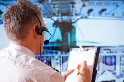
NASHUA, N.H. — Almost every airline passenger has experienced it. You're looking out the window as the aircraft descends through thick clouds. There isn't a runway in sight, yet a few moments later the wheels touch down almost exactly where you expected. It can feel like the pilots are landing blind. They're not.
When the weather is clear, pilots can use outside visual references to judge their position. They can see the runway, line up with the centerline, and adjust the aircraft as they descend. Clouds and fog change that almost immediately. Instead of relying on what they can see, pilots turn to instrument flight.
They rely on layers of navigation, sensing, and flight-control technology, including radio signals, satellite navigation, and inertial sensors that guide the aircraft long before the runway comes into view. These systems work together to guide the vehicle with greater precision than the human eye could provide through poor visibility.
Related: FAA eVTOL pilot program drives demand for detect-and-avoid and sensor fusion technologies
The runway sends guidance to the aircraft
One of the oldest (and still one of the most important) landing technologies is the Instrument Landing System, or ILS. Rather than telling the aircraft where the runway is, ILS creates an invisible approach path using two radio signals transmitted from equipment beside the runway.
The localizer keeps the vehicle lined up with the runway centerline. The glideslope keeps it on the correct descent angle. As the airplane moves, onboard receivers continuously compare its position to those signals and display even small deviations to the flight crew. Pilots then make small corrections throughout the approach, allowing the aircraft to remain on a stable path all the way to the runway.
Even as satellite navigation becomes more common, ILS remains one of the most accurate landing aids available at commercial airports.
But ILS is only one piece of the picture. Commercial aircraft constantly compare information from multiple navigation systems instead of depending on a single one. Satellite receivers determine position, inertial reference systems continue tracking movement even if satellite signals become unavailable, and air data computers calculate speed and altitude throughout the flight.
During the final moments before touchdown, another sensor becomes especially important. A radar altimeter measures the aircraft's actual height above the terrain by transmitting radio waves toward the ground and timing how long they take to return. That measurement becomes critical during the flare, when the airplane gently reduces its descent rate just before the wheels touch down.
Autoland requires much more than autopilot
Many passengers assume an autopilot can automatically land any airplane. The reality is a bit more complicated, though. Automatic landing requires redundant flight computers, navigation receivers, sensors, electrical systems, and software that continuously compare data before making control inputs. Those programs allow another component to take over if one stops working, helping the aircraft continue the landing safely.
Even then, pilots remain in the loop. They monitor every stage of the landing and can disconnect the automation if weather, traffic, or aircraft performance changes unexpectedly. Contrary to popular belief, autoland doesn't replace pilots. It gives them another tool for operating safely when visibility drops to very low levels.
The airport is part of the system too
The aircraft isn't the only part of the equation. Airports maintain localizer and glideslope antennas, lighting systems, and other ground equipment that support precision approaches. Many are also adopting Ground-Based Augmentation Systems (GBAS), which boost the accuracy of satellite navigation and allow multiple precision pathways from a single installation.
Together, the aircraft and the airport create a shared system that guides every approach from several miles away until the aircraft reaches the runway.
Landing in the clouds is really an electronics story
While passengers often remember the moment the runway suddenly appears through the fog, engineers see something entirely different. They notice radio navigation, satellite positioning, inertial sensing, radar altimetry, and flight computers working together exactly as designed. None of those systems would be enough on their own.
Combined, they allow commercial aircraft to land safely in weather that would have grounded flights decades ago.
About the Author
Samantha McGrail
Associate Editor
Related
Voice Your Opinion!
To join the conversation, and become an exclusive member of Military Aerospace, create an account today!
 Leaders Logo
Leaders relevant to this article: